The Río de la Plata is the widest river in the world and one of the most dangerous for navigation
What we now
call the Río de la Plata does not lead to any region rich in this metal and to
a large extent it is the result of a historical contradiction of navigators who
were looking for the great silver deposits of Upper Peru through this route and
the name finally stuck.
The native
peoples called this hydrographic macro-accident with words that we do not know,
although we know that the Guaraní peoples called it “pará guazú” (from “pará”
extensive waters, sea and “guazú” large). In other words, a large area of
marine waters. Even today the main arm of the Paraná River in its delta is
called “Paraná Guazú”.
It is
difficult to imagine the geological history of the body of water that we now
call the Río de la Plata.
Geologically,
the Río de la Plata is of recent origin, that is, a little over 10,000 years, which
in geology is a very short time. Let's say that about 15,000 years ago the
current bottom of the river was dry land, it was emerged and constituted a low
plain in the axis of which a fluvial channel was established, a kind of
paleoplate that emptied into the Atlantic Ocean forming a silt-sandy delta at
the height of the imaginary line Punta del Este-San Antonio.
At that
time, large amounts of silty dust (loess) arrived, which crossed and
accumulated on the surface of that ancient plain (today covered by water) and
towards the adjoining undulating areas and which would constitute the majority
of the agricultural soils in the coastal territories on both shores.
The climate
of that period was semi-arid and colder but there was enough vegetation to
support several large mammals such as glyptodonts (giant species of finches), mylodons
and megatheria (giant sloths) and mastodons (relatives of elephants). We must
point out that at that time (about 10,000 years ago) the first human
communities arrived in this region. We know that they were responsible for the
extinction of the giant species we were talking about. These human communities
have probably also been able to witness the flooding processes of the low
plains that gave rise to the formation of the Río de la Plata as we know it
today.
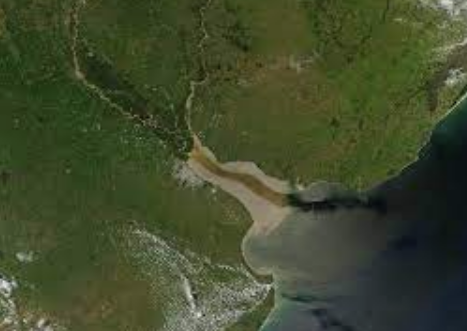
Today it is
a roughly triangular water surface that extends for 325 kilometers in a
northwest to southeast direction. Its surface is 30,400 km2.
The
southwestern shore, which corresponds to Argentine territory, is made up of low
plains, often flooded, while the northeast shore is higher, made up of beaches
and rocky points, with a foreland of gently undulating relief, corresponding to
Uruguayan territory.
The Río de
la Plata is shallow. The average depth does not exceed 10 meters reaching its
maximum depth is 25 m. on the imaginary line that determines its outer limit. There
are numerous areas with much shallower depths that are called "banks"
including the extensive Banco Ortiz, with a sandy-loam composition off the
Uruguayan coast of San José with depths of 2 to 4 meters, and the less
extensive Banco Inglés but with less depth ( 0.5 to 3 meters) composed of rocky
substrate locally covered with sand. Other smaller banks are Banco Archimedes
and Rouen. These banks are important because they represent obstacles to
navigation and are responsible for numerous shipwrecks.
On the
other hand, the wide opening of the Río de la Plata gave and gives rise to the
entry of salty ocean waters during periods of lower fluvial flow and high tides
and the advance of fresh waters contributed by the Paraná and Uruguay rivers
during periods of heavy rains and low tides. Salt water tends to advance below
fresh water with relatively little mixing. This characteristic regime of the
Río de la Plata is called the estuarine regime.
The Río de
la Plata is a powerful aquatic entrance to the continent that was used for
maritime access to the main rivers. On the southwestern shore, the port of
Buenos Aires was established in 1580) and on the northeast, the port of
Montevideo. At different times other ports were established (Colonia, Maldonado,
La Plata) but they never had the importance of these two main ports mentioned
above.
The Río de
la Plata is generally navigable (depth of the channels of more than 8 meters) but
due to the presence of shallow banks it requires accurate bathymetry to avoid
shipwrecks. A regime of frequent storms and fog has made navigation even more
difficult.
We can say
that in fact, in a certain way, the history of the Río de la Plata is the
history of the great shipwrecks that occurred in it.
The first
obstacle that appears to ships sailing into the Río de la Plata from the
oceanic northeast is the island of Flores. It is located about 10 kilometers
from the nearest coast and 25 kilometers from the port of Montevideo.
It is 1,800
meters long and a maximum of 300 meters wide. It has been occupied since
colonial times. A field hospital, a powder keg and finally a pesthouse were
installed there, for the quarantine of slaves. In the Portuguese era, a
lighthouse was built and there was a headquarters for the Military Command and
the Post and Telegraph Office, a Maritime Sanitary Station for ships with sick
people that had a Disinfection Department.
About 18
kilometers south of the island of Flores and 28 kilometers from the nearest
Uruguayan coast is the so-called
English
Bank. It is an old rocky elevation, perhaps granite, which, when the old plain
was flooded, remained as an elevation of the bottom of the river and whose
highest peak is about 0.5 m from the surface of the water, with breakers on its
northern edge appearing during the extraordinary downspouts..
It extends
from north to south with a length of 18 kilometers and almost 4 kilometers wide
with a perimeter of 75 kilometers and an area of 17,000 ha. Its average
sounding of 5 meters. for the entry and exit of overseas ships from the ports
of the Río de la Plata and the rivers that flow into it. From this area starts
the access channel to the port of Montevideo and the Punta Indio channel that
from the Recalada Pontoon (a ship maintained by Argentina for boarding pilots) leads
to the port of Buenos Aires and to the others in the Plata basin.
The space
between the island of Flores and the English bank constitutes the gateway to
the Río de la Plata and the ports both in the estuary and in the interior
rivers.
Most of the
shipwrecks are related to the coastal restingas and rocky points, as well as
those that occurred in the English Bank and on the Island of Flores itself.
In
particular, the shipwrecks caused by the English bank have been numerous and
the salvage of the vessels or their crews very difficult due to the distance to
the coast and the lack of references.
No comments:
Post a Comment